
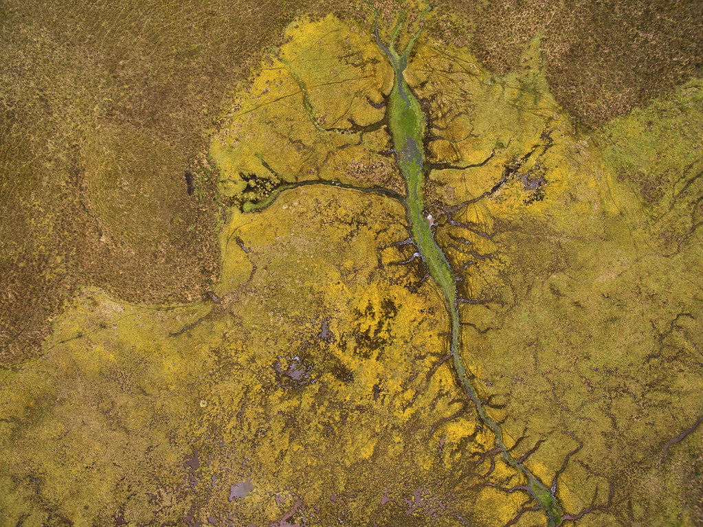
While working with FONAG, Foundation for the protection of waters, in the Ecuadorian Paramo, we documented the Rio Pita, one of the most important contributors to Quito's water supply (roughly 30%). Here is a point close to the source at the foot of Sincholagua volcano. Photographed by P3P drone.
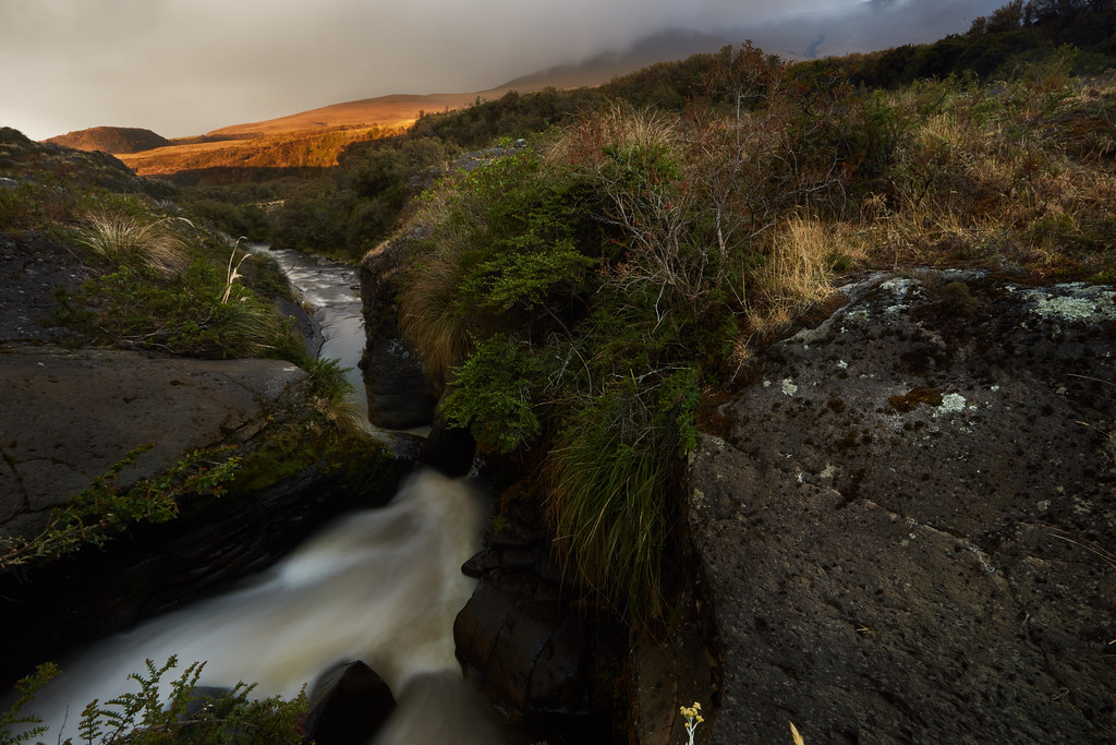
Documenting the length of the Rio Pita provided tons of great opportunities for dramatic captures like the river coursing into a canyon at sunset, whilst fog rolled in from the east:
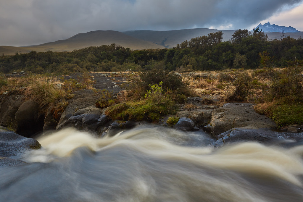
Sincholagua, the source of the Rio Pita can be seen in the distance as the river courses through yet another canyon:
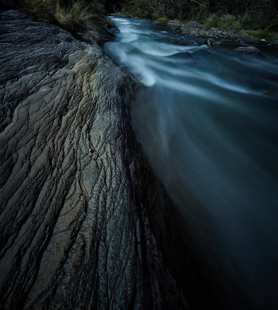
4 volcanoes ring the area where I was staying, as such some of the river bed and surrounding areas is volcanic in origin with beautiful striated textures:
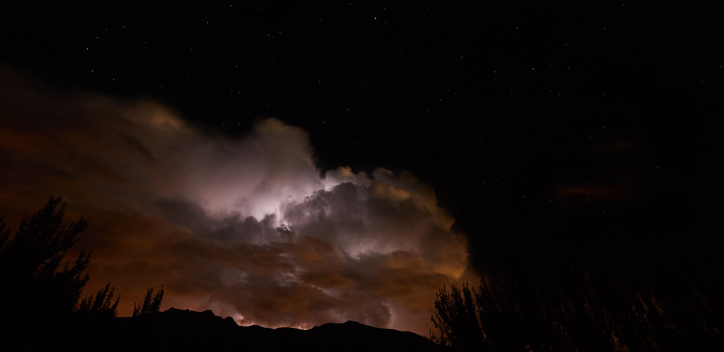
Lastly, the Paramo is prone to fickle weather with clouds rolling in and out with hardly a moment's notice. My last night there and we were treated to a lightning storm over Pasachoa, one of the volcanoes close by.
Thanks for looking and commenting, as always C&C is most welcome,
Cheers,
Paul

